Smart Topography Survey
Precision from the Ground Up. Leveraging advanced drone technology and LiDAR systems to provide high-fidelity terrain data for informed architectural and engineering decisions.
SHAPING DESIGNS WITH TOPOGRAPHIC PRECISION
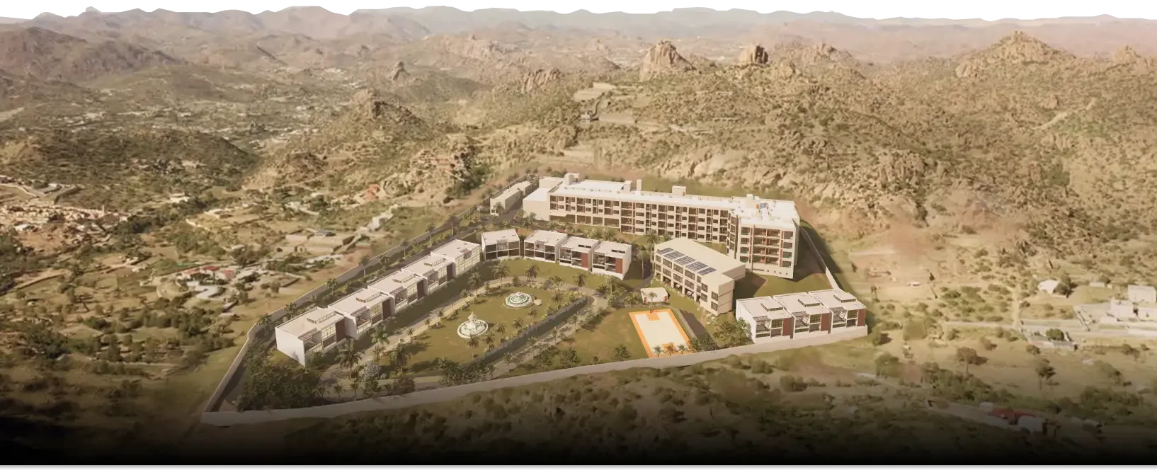
At MIMAR, our Smart Topography Survey services are the foundation of every successful project. We utilize cutting-edge LiDAR and drone technology to capture high-resolution, real-time terrain data. By bridging the gap between physical land and digital design, we provide the clarity needed to optimize site layouts, manage environmental impact, and ensure structural integrity from day one.
OUR DESIGN PROCESS
Site Reconnaissance
Defining project boundaries and establishing high-precision ground control points (GCPs) to ensure absolute geodetic accuracy across the entire site.
Aerial Data Acquisition
Deploying advanced UAVs (Drones) equipped with LiDAR and photogrammetric sensors to capture millions of data points and high-resolution imagery.
Terrain Analysis & Modeling
Processing raw point clouds into detailed 3D mesh models, contour maps, and digital elevation models (DEM) for a comprehensive understanding of the site.
BIM & CAD Integration
Delivering actionable data in industry-standard formats, allowing architects and engineers to begin design work with perfect spatial awareness.
BENEFITS
Centimeter-Level Accuracy
Our advanced sensors eliminate the margins of error common in manual surveying, providing a "digital twin" of your land with pinpoint precision.
Rapid Data Turnaround
What used to take weeks of ground-prowling now takes hours. We deliver comprehensive site data faster, keeping your project timeline ahead of schedule.
Vegetation Penetration
Using LiDAR technology, we can map the true ground surface even through dense forest or heavy brush, revealing hidden terrain features.
Cost Risk Mitigation
Identify drainage issues, soil movements, and slope challenges early. Precise data prevents expensive design changes and construction delays.
GET A DETAILED SITE ANALYSIS
Precision Now, Excellence Later: Why guess?
With our Smart Topography Surveys, your project begins with total site clarity,
ensuring a seamless transition from digital planning to physical construction.