

/ Islamabad, Pakistan
Faisal Town II
A wide-ranging urban development study covering its CBD, lake district and stadium.
/ Key specs
Client
Non-disclosed
Location
Islamabad, Pakistan
Typology
Master-planned community
Area
Project specific
Faisal Town II master plan renders in Islamabad
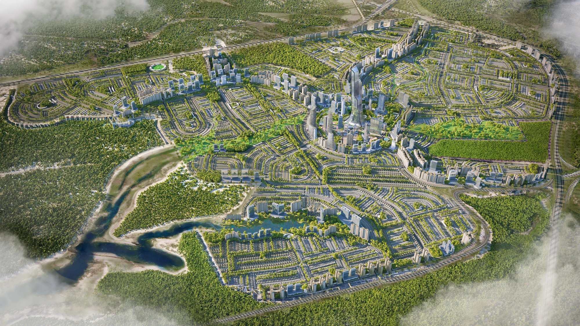
Faisal Town II, or Faisal Town Phase 2, is a large urban development in Islamabad, Pakistan. Mimar Studios' urban planning renders cover the whole plan and its key districts: a central business district, a lake district, a golf course and a stadium.
The night aerial shows the full plan at once, with lit ring roads around neighbourhoods that curve towards a central tower. The district views come closer: glass office towers beside the golf course and its lake, a dusk view from a balcony over the lake district, and a floodlit stadium ringed by plazas and parking. Each one gives investors a picture of a part of the city that is still a plan.
Faisal Town II visual showcase
Faisal Town II FAQs
What did Mimar Studios visualize for Faisal Town II?+
Urban planning renders of Faisal Town II (Phase 2) in Islamabad: aerials of the master plan by day and at night, the business district, the lake district, the golf course and the stadium.
What districts does the Faisal Town II plan include?+
The renders show a central business district with glass office towers, a lake district with residential towers along the water, a golf course, a stadium, and neighbourhoods linked by ring roads and green corridors.
Why visualize a master plan at night?+
At night the road network and the centres of activity light up, so the structure of the plan is easier to read than in daylight. It also gives the project a striking hero image for presentations.
/ Related services
/ Get in touch
Planning a community?
Let us design it with you.
Share a few details about the project and one of our architects will get back to you within a day.
/ Next project
HMRKarachi, Pakistan