
/ Mimar insights
Mega Project Visualization in Saudi Arabia: How It Shapes Development
Mega project visualization in Saudi Arabia: how masterplan renders, scale studies and interactive tools help Riyadh developers brief investors and buyers.
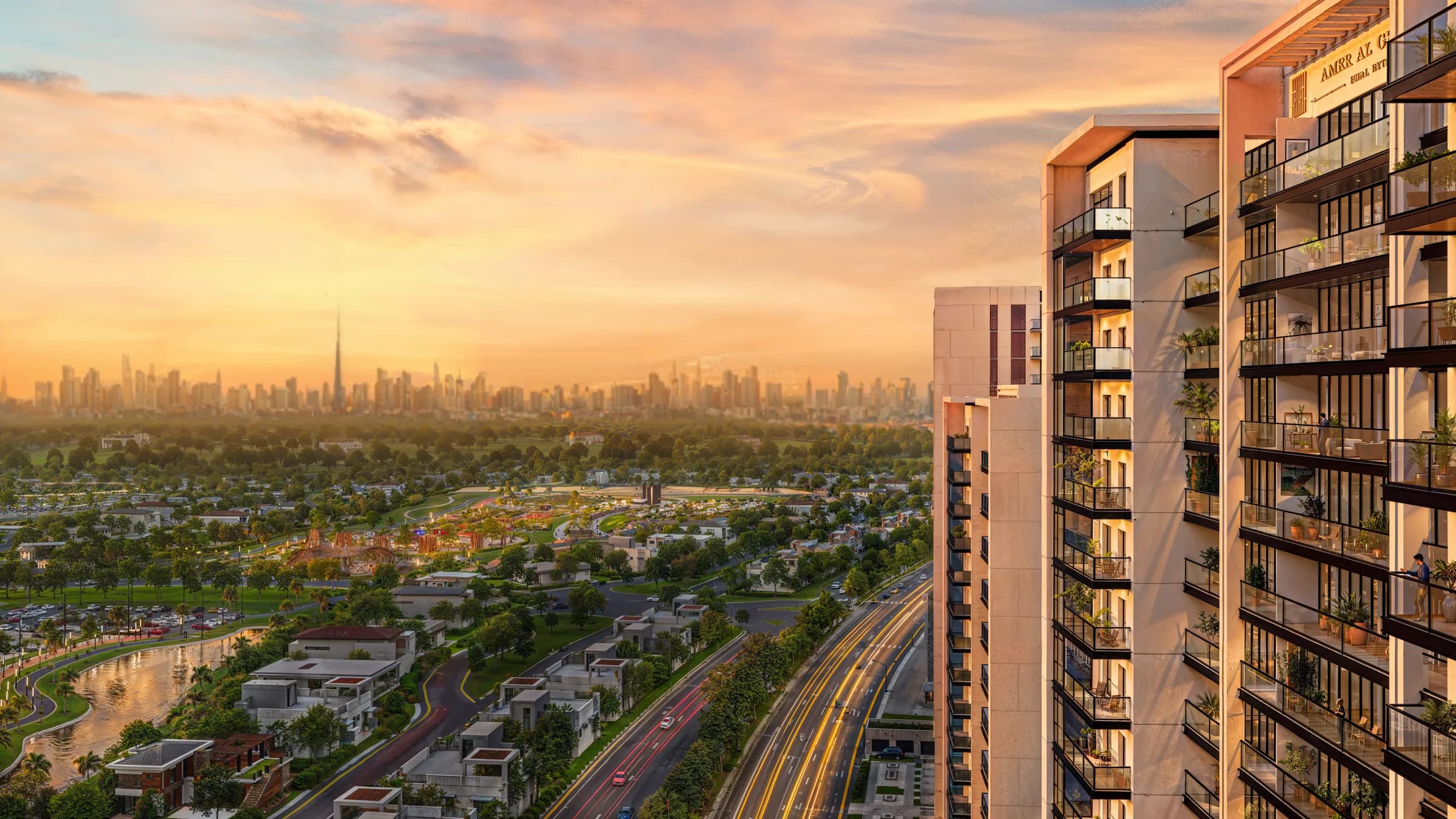
Mega project visualization in Saudi Arabia has become a discipline of its own. Projects in the Kingdom often cover whole districts rather than single buildings. Explaining that scale to investors, buyers and partners is hard with drawings alone. This guide explains how masterplan renders, scale studies and interactive tools help developers in Riyadh and across Saudi Arabia communicate projects of this size.
Key takeaways: mega project visualization in Saudi Arabia
Large Saudi projects need visuals that work at every scale, from the masterplan to the street.
Aerial and masterplan renders explain layout, phasing and connections at a glance.
Street-level views make a vast project feel human and walkable.
Interactive floorplans and explorers keep investors engaged during roadshows.
One coordinated model saves time as designs change across phases.
Visualizing Saudi Arabia's Architectural Expansion
Saudi Arabia is in the middle of a construction program of unusual size. Under Vision 2030, new districts, destinations and mixed-use communities are planned across the Kingdom. Many of them combine housing, offices, retail, hotels and public space in a single development.
Projects of this kind are hard to picture. A masterplan drawing shows plots and roads, but not what it will feel like to live or work there. That gap matters, because the people who fund and buy into these projects need to see the finished place.
The audience is also wider than for a single building. A large Saudi project may need to persuade government partners, international investors, operators of hotels and retail, and thousands of future residents. Each group reads the project differently. Mega project visualization in Saudi Arabia gives them a common reference, so discussions start from the same picture rather than from different assumptions.
Communicating Scale for Mixed-Use Developments in Riyadh
Mixed-use developments in Riyadh often stretch across many hectares. Visualization helps in three ways. Aerial views explain how the parts fit together. Mid-level views show how a district connects to roads and transport. Eye-level views show the shaded streets and plazas where people will actually spend time.
Each view answers a different audience. Investors look for the big picture and the phasing. Retail tenants want footfall and frontage. Future residents want to see their home, their walk to the mosque and their children's school.
Mega Project Visualization in Saudi Arabia, from Masterplan to Street Level
Good mega project visualization in Saudi Arabia starts with the masterplan and works downward. The first deliverable is usually an aerial render of the whole site, showing land use, landscape and landmarks within the project. Our aerial visualization service is built for these overview images.
Aerial views need care to stay readable. A site of many hectares can turn into a confusing pattern of roofs. Good masterplan renders use clear landscape, simple building massing in the background and stronger detail at the key destinations. Labels and soft overlays can mark districts, routes and phases without cluttering the image.
From there, the work zooms in. Key nodes, such as a central boulevard, a waterfront or a main plaza, get their own detailed views. Finally, typical buildings and units are shown at full detail for sales.
Phasing is a particular challenge. A project built over many years should show what exists at each stage. Clear phase images stop buyers in phase one from expecting facilities that open much later. They also help planners and partners discuss priorities.
A shared 3D model makes this manageable. When the masterplan changes, the model is updated once and every view follows. That is far faster than redrawing separate images, and it keeps the whole visual story consistent.
Interactive Tools for Investor Roadshows in Riyadh
Investor roadshows, exhibitions and expos are central to how large Saudi projects raise interest. A printed brochure struggles to hold attention at a crowded event. Interactive tools do better, because visitors can explore the project themselves.
A presenter can fly from the masterplan to a single district, then into a typical apartment, answering questions as they come. Visitors remember an experience they controlled far better than a slide they watched.
For mega project visualization in Saudi Arabia, roadshows abroad add another need. Teams travel with limited equipment and unreliable venue internet. Tools that run offline on a laptop or a large touchscreen avoid embarrassing failures in front of investors. A short film loop on a second screen keeps the stand active while the presenter talks to individual visitors.
Using Interactive Floorplans to Drive Pre-Sales Engagement
Interactive floorplans let buyers pick a building, a floor and a unit, then see its plan, its view and its availability. Our property explorer does this on a screen at a sales center or online. For pre-sales, it turns interest into specific enquiries about real units.
The same tool supports sales teams. They can update availability in one place and show only units that are still on the market. That keeps every conversation accurate.
Choosing Mega Project Visualization in Saudi Arabia: Market Considerations
Working on projects in the Saudi market brings some practical needs. Visuals often need both Arabic and English versions. Cultural details matter, from privacy screening and family spaces to the way public areas are used through the day. Climate matters too: shade, landscape and evening activity are central to how places are used.
That last point shapes the images themselves. A plaza in Riyadh may be quiet at noon in summer and busy after sunset. Showing it at the right time of day, with shade structures, planting and people dressed for the climate, makes the project believable. Images that copy a European street scene can look out of place to Saudi buyers.
Schedules can be tight, and design teams often sit in several countries. A studio that works the Sunday to Thursday Gulf week keeps feedback moving without delays. Mimar Studios works from an office in Jeddah, and our Saudi work includes NANA 222, a contemporary development in Riyadh.
When you choose a partner, look for experience at several scales, a clear revision process and the ability to keep one model current as the design evolves. You can see our full approach to 3D visualization services in Saudi Arabia.
Mega project visualization in Saudi Arabia works best when it is planned like the project itself: from the whole site down to the single home, in phases, and with one source of truth.
Frequently asked questions
- What visuals does a Saudi mega project need first?
- Most projects start with an aerial masterplan render that shows land use, landscape and the main destinations. Detailed street views and unit interiors usually follow once the design of each phase is settled enough to show accurately.
- How do you show phasing in project visuals?
- Each phase gets its own set of images showing what will exist when it opens. This keeps buyers in early phases from expecting facilities that arrive later, and it helps partners discuss priorities across the full timeline.
- Do projects in Riyadh need Arabic and English visuals?
- Many do, because projects in Riyadh market to both Saudi and international audiences. Labels, captions, film titles and interactive tools are often produced in both languages from the same model so the content matches.
- Are interactive floorplans useful at investor events in Saudi Arabia?
- Yes. At busy exhibitions and roadshows, interactive tools let visitors explore the project themselves, which holds attention better than printed material and leads to more specific questions about units and phases.
- How do visuals stay accurate when a masterplan changes?
- The safest approach is a single 3D model that every image, film and tool is drawn from. When the masterplan changes, the model is updated once and all outputs follow, instead of correcting each image separately.